Mapping People and Change | LSE Festival

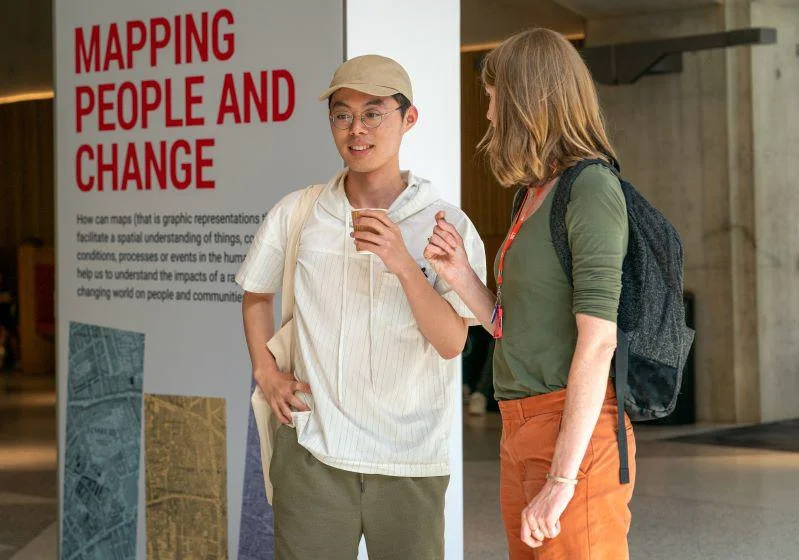
How can maps (that is graphic representations that facilitate a spatial understanding of things, concepts, conditions, processes or events in the human world) help us to understand the impacts of a rapidly changing world on people and communities?
From socio-economic inequalities in London and the UK, to our changing environment, language and health across the world, the exhibition brings together research from across the social sciences.


More about this exhibition
This exhibition is part of which took place from Monday 12 to Saturday 17 June 2023, with a series of events exploring how change affects people and how people effect change.
Projects on display (including pdfs of the final displays):
The Land Utilisation Survey of Britain
The Library houses around 15,000 maps showing detailed usages of land across England, Wales and much of Scotland in the 1930s. Described as a modern Domesday Book, these maps were produced by a network of volunteers, including many schoolchildren, up and down the country, who filled out details about how each parcel of land was being used. The survey was headquartered at LSE and directed by geographer and LSE Professor, Sir Dudley Stamp. The value of the project became clear during World War 2 when the Government used it to help plan and organise the increase in domestic food production.
How children visualise cities of today and tomorrow
How do children see urban inequalities and the transformation of cities? What would they change in their neighbourhoods? What kind of cities do they wish for? periferias dibujadas is an ongoing project that creates spaces for children in different places across Europe to research, narrate and intervene in their urban contexts. Their images explore issues affecting cities today, such as access to housing, racism, gentrification and the impact of tourism, and show their visions for more liveable and just cities.
Research by Kitti Baracsi, Atlantic Fellow for Social and Economic Equity, in collaboration with numerous children, researchers, educators, teachers, artists and other citizens.
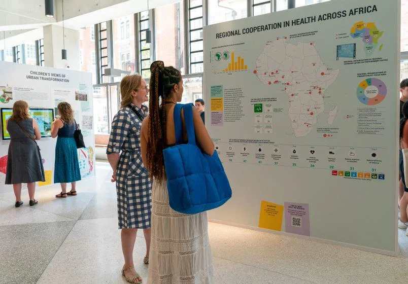
COVID-19 highlighted the need for multilateralism in health and weaknesses in existing structures of cooperation. Africa has a long history of using regional cooperation to build African agency and resilience in health. But little is known about the type or scope of health activity undertaken. By mapping regional organisation health activity on the continent across health-related Sustainable Development Goals (SDGs), we can better understand their potential to bridge governance gaps and respond to health challenges, in Africa and beyond.
Research by Beth Kreling, Dr Catherine M Jones and Dr Lesong Conteh, LSE Health.
Evidence from the use of proverbs
Proverbs are concise, memorizable, and metaphorical sentences summarizing ideas, arguments, norms, or folk wisdom. They are a universal feature of human languages and cultures that reflects the beliefs, values, and worldviews of a society. Examining broad cultural transformations, such as the First Industrial Revolution in Britain, can be informed by the prevalence and evolution of proverbs. Researchers are using the newest generation of AI models to interpret a collection of 25,000 proverbs from pre- and post- industrial Britain. Encoding or clustering algorithms are used to group the proverbs into interpretable topics based on their moral and behavioural implications.
Research by Dr Melanie Meng Xue, Department of Economic History, LSE and Dr Elliott Ash, ETH Zurich.
The UK’s Global Economic Elite
The UK’s new economic elite is cosmopolitan and international, driven by finance and global capital flows. Using de-identified administrative microdata from the full tax returns of every individual who claimed non-domiciled (‘non-dom’) status from 1997–2018, researchers have revealed detailed information about these elite groups. The non-dom phenomenon as a whole is very largely restricted to London and the South East. Discussions of the role of London as a ‘global city’ need to be tempered by the realisation that it is specific kinds of elite international networks in play.
Research by Dr Arun Advani, David Burgherr, Professor Mike Savage and Dr Andy Summers, LSE International Inequalities Institute.Read more.
Booth Poverty Maps
Charles Booth's Maps Descriptive of London Poverty were the most famous product of his Inquiry into the Life and Labour of the People in London, a survey of working undertaken between 1886 and 1903. An early example of social cartography, each street is coloured to indicate the income and social class of its inhabitants. The colours of adjacent classes have not been chosen to emphasise distinction: in fact, similar classes have similar colours. This allows general trends across the city to be made apparent.
The archive of Charles Booth's inquiry is held by LSE Library, and can be accessed in the Library's reading room. The digitised version of the full map can be viewed free online.
In the aftermath of the Grenfell Tower Fire, which took place six years ago, LSE researcher Flora Cornish collaborated with Cathy Long (a local safety campaigner and community researcher) and Toby Laurent Belson (a local community artist and designer), to interview a wide range of community responders, and then visualise five timelines of the community experience of the unfolding of the disaster response. These maps of experience over time have contributed to sense-making, recognition and pride for residents. They provide a repository of past experience and connections for those affected by future disasters, as well as a nuanced understanding of community resilience after disasters for emergency management professionals and the voluntary sector.
Research by Dr Flora Cornish, Department of Methodology.
Has it become easier to be the first in your family to get a degree?
In 2022, around 368,000 people in England obtained a first degree according to the Higher Education Statistics Agency. To better understand changes in social mobility, researchers have looked at the chances of becoming the first in your family to get a university degree. This map will show that probability has changed over time, in different regions of England, by tracking the progress of people born in 1958, in 1970 and in 1989. Does where you grow up make a difference to your life chances?
Where People Live
Accommodating over 20 million people, Mexico City is the largest city in the world. Located on flat open land, the city has continued to grow outwards. The average density is similar to London, but without London’s parks and gardens. For many decades, poor planning and uncontrolled development have stretched the city and its services. Poorer residents living on the edges face a four-hour commute every day.
This exhibition will feature a model, on loan from Bletchley Park Trust, visualising the population density of Mexico City, showing the number of people living in each square kilometre (represented by a hexagon) of a 100km x 100km urban region. The taller the spike, the more people live there. The coloured area is the administrative boundary of the city and any peaks outside show urban residential sprawl. The model has been developed by LSE Cities using data from the 2015 World Global Human Settlement (GHS) population grid.
See more models using LSE Cities data, plus other unusual and creative data visualisations, in ‘The Art of Data’ exhibition at Bletchley Park, open until December 2024.
Where Cities are Growing
The world’s urban population is unevenly distributed. African and Asian cities are growing faster than ever; Latin America has slowed, while Europe and North America have peaked.
Five billion people will live in cities by 2030. How they are planned will determine how they grow. Low-density sprawl negatively impacts resources and infrastructure, increasing commutes and stretching public services, while compact cities are socially and environmentally sustainable.
The research project, jointly organised by LSE Cities and the Alfred Herrhausen Gesellschaft from 2005-2022, has produced data visualisations to show where cities are growing.
Global trends indicate that the prevalence of low subjective well-being is on the rise – across the world, people report increasingly more negative emotional experiences day to day. This is a trend that would provoke panic amongst policymakers if reflected in another measure, for instance GDP, but has so far been largely ignored and remains unexplained. No single factor is responsible for this trend but LSE researchers are exploring what the reasons behind it might be.
These trends are ascertained from data from the Gallup World Poll (GWP) - an annual survey conducted from 2005 to 2021 that is, as a result of a probabilistic sampling strategy, representative of 98 per cent of the world’s population. The sample includes 164 nations, with a sample size of more than 1.8 million observations. It is the largest and most representative sample of well-being data from the world’s population available. The poll captures individuals’ reports of both positive and negative experienced well-being "yesterday".
Research by Professor Paul Dolan, Dr Laura Kudrna, Dr Kate Laffan, Dr Georgios Melios, Department of Psychological and Behavioural Science, LSE and Institute of Applied Health Research, Birmingham University.
Extractive infrastructures effect monumental and irreversible changes to the lives of people and the environment. This map by visual artist and activist Cian Dayrit uses grassroots counter-mapping to represent the impacts of the implementation of the Kaliwa Dam project on indigenous land and water in the Philippines. The map illustrates how, in the state provision of water, large dams serve the profit-making agenda of private water corporations and support government counterinsurgency activities.
The engineer’s cartography of the dam site is overlaid with a countermap from indigenous communities with QR codes to online resources about the Kaliwa Dam project.
A guide to the QR codes embedded in the map:
A 5-minute video about dam impacts on ancestral lands, indigenous resistance, and on-going dam development in the Philippines
An article mapping anti-dam movements in the Philippines using the Global Atlas of Environmental Justice
Tunnel Boring Machine, Sampaguita, starts its operation for Kaliwa Dam Project
Financing and operation of large dams by the private sector
Building hydropower dams in decline globally
News article reported flood alerts as dams spill over due to typhoon
A 15-minute video on the dictator Marcos Sr.’s legacy, the Kaliwa Dam Project, produced by the Metropolitan Waterworks and Sewerage System
Water privatization in the Philippines creates inequality in people’s access to potable water
Kaliwa Dam Project profile
An article about the indigenous resistance against the Kaliwa Dam project, November 2019
Research by Cla Ruzol, Department of Anthropology.
Restoring our planet’s health requires us to question our current ways of living so that humanity can flourish within the planetary boundaries that set sustainable limits on the impact of human activities on earth. People have different views of what planetary health looks like and how we can achieve it.
The Planetary Health Teamin the Psychological and Behavioural Science Department at LSE carries out research on the psychological and behavioural underpinnings of planetary and environmental health. As part of LSE Festival they are collecting data on people’s perspectives on planetary health.
Research by Dr Kate Laffan, Dr Fred Basso, Dr Ganga Shreedhar, Dr Matteo Galizzi, Dr Dario Krpan, Department of Psychological and Behavioural Science, LSE.
LSE holds a wide range of events, covering many of the most controversial issues of the day, and speakers at our events may express views that cause offence. The views expressed by speakers at LSE events do not reflect the position or views of The London School of Economics and Political Science.
From time to time there are changes to event details so we strongly recommend that if you plan to attend this event you check back on this listing on the day of the event.
LSE holds a wide range of events, covering many of the most controversial issues of the day, and speakers at our events may express views that cause offence. The views expressed by speakers at LSE events do not reflect the position or views of the London School of Economics and Political Science.
Join the LSE Events mailing list
Sign up to receive newsletters about upcoming public events and exhibitions at LSE.
